1
The aerial map
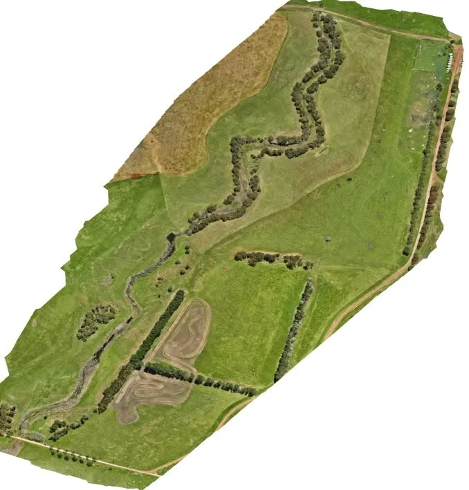
A current, scaled, top-down photo map of your whole property, stitched from hundreds of drone images. Measure paddocks, fence lines, tracks and distances, and see far more detail than satellite imagery.

Prefer to talk?
1300 49 42 99Farmers · Landholders · Regional VIC
CASA-approved · ReOC 9714
Contour maps, full-property aerial maps and crop health scans, flown with RTK accuracy by a CASA-approved pilot.
2D orthomosaic map
Orthomosaic · full-property photo map
What you get
A current, scaled, top-down photo map of your whole property, stitched from hundreds of drone images. Measure paddocks, fence lines, tracks and distances, and see far more detail than satellite imagery.
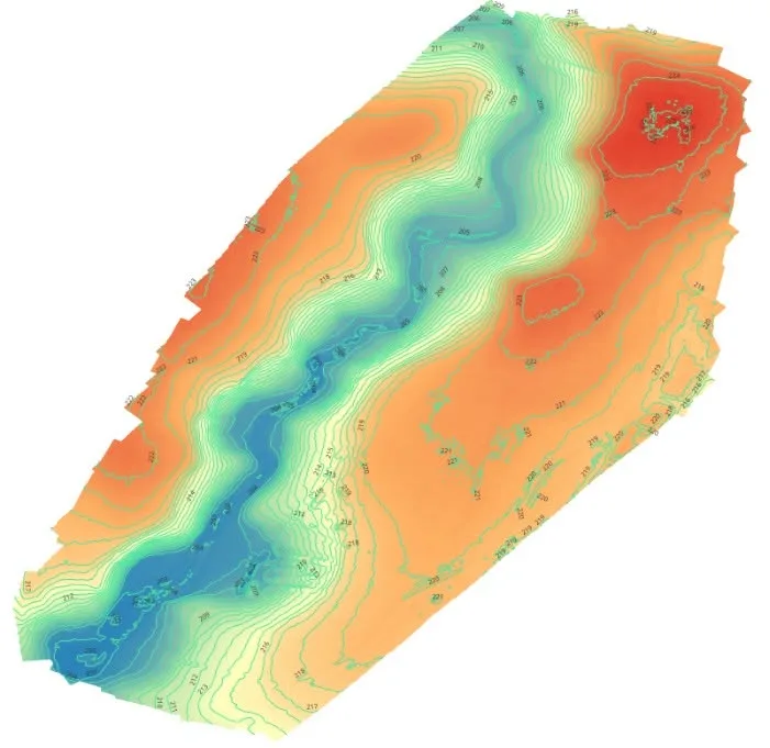
Elevation in colour with contour lines, so you can see exactly where water runs, where it sits and where the high ground is. Plan dams, drainage, laneways and earthworks from real levels.
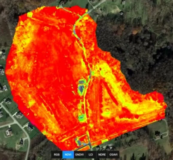 Example
Multispectral imagery turned into NDVI and NDRE maps. Green is thriving, red is stressed. You see which patches need a closer look before walking every paddock.
Not every job needs all three. Tell us what you're planning and we'll quote only what's useful.
Services
A scaled aerial map of your whole property or site, with a pre-flight site check, high-resolution imagery and video, and documentation of fences, tracks, sheds and infrastructure. Delivered by secure cloud link.
RTK elevation data with colour-coded heights and contour lines. Built for farm planning, land development, earthworks and infrastructure.
Multispectral NDVI and NDRE maps that show variation in plant vigour across every paddock, so you or your agronomist know where to check, test or treat first.
Contour and flow data for planning dams, drains, crossings and laneways. Hand it to your earthmover or designer before work starts.
Current orthomosaic and elevation data for early design, feasibility and earthworks planning on development land.
Aerial, contour and crop health maps from a single visit, so one flight answers several questions.
Site & Topographic Mapping
from $1,500 + GST
Pre-flight check, aerial imagery and video, 2D orthomosaic map, cloud delivery
Crop Health Scan
quoted per property
Multispectral capture with NDVI and NDRE maps
Price depends on area, terrain and airspace. Permits and approvals may add fees. For title boundaries or certified surveys you'll need a licensed surveyor — we're happy to supply data to yours.
"Our goal is simple: provide reliable aerial data that improves visibility, supports safer operations, and helps projects stay on track."
Brett Mitchell has spent more than 30 years in the building industry and holds a private pilot licence with over 3,500 hours in the air. He knows why levels matter — whether you're placing a dam, a house pad or a new laneway — and every flight follows CASA's CASR Part 101 rules.
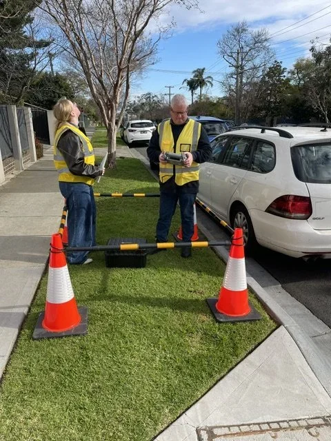
We fly an RTK drone backed by a DJI D-RTK 3 local base station and network RTK (NTRIP) correction, giving far more accurate positioning than a standard drone and far more current detail than public elevation data. Multispectral paddock health scans add a view of what's happening in the crop itself.
Why RTK matters
A DJI D-RTK 3 base station and network correction on every mapping flight.
Contours show the flow paths and low spots behind wet paddocks and washouts.
Multispectral scans flag stress you can't see from the ute.
Files your earthmover, agronomist, surveyor or engineer can open.
What you can check before you book
ReOC 9714 — check the CASA register.
Certificate of currency on request.
We confirm the formats your agronomist, earthmover, engineer or designer needs before we fly, and deliver by secure cloud link.
Unsafe to fly? We rebook at no cost.
We work around stock, crops and your day. Tell us about gates, livestock and access, and we'll plan the flight around them.
Opt out of marketing use, in writing, any time.
Based in Melbourne and flying statewide — broadacre, grazing country, horticulture and development land on the urban fringe.
FAQ
A 2D orthomosaic is a scaled aerial photo of your property — what's on the ground and where. A topographic map shows height: colour-coded elevation and contour lines that reveal slopes, low spots and where water flows. Many clients get both from the same flight.
We fly an RTK drone with a DJI D-RTK 3 local base station and network RTK correction, which gives far more accurate positioning than a standard drone and far more current detail than public elevation data. Exact accuracy depends on terrain, ground cover and conditions, so we'll talk it through before we fly. For title boundaries, legal set-out or certified surveys, you need a licensed surveyor — we're not one, and we're happy to supply our data to yours.
It maps variation in plant vigour across your paddocks using multispectral imagery (NDVI and NDRE), so stressed areas stand out from healthy ones. It shows you where to look; it doesn't diagnose the cause. Waterlogging, nutrition, pests and disease can all look similar, so use the map to direct soil tests, tissue tests or your agronomist's walk.
Usually during active growth, when there's enough canopy for differences to show and still time to act. Tell us the crop and sowing date and we'll suggest timing. Repeat scans through the season can be quoted.
From house blocks and development sites to whole farms. Larger properties take longer to fly and process, which is reflected in the quote. Tell us the approximate hectares and what you want to know, and we'll scope it.
Depending on the job: the orthomosaic map, contour and elevation maps, crop health maps, and aerial photos. Everything comes through a secure cloud link, in formats we confirm before the flight so your agronomist, earthmover, engineer or designer can use them. Final files are released once the invoice is paid.
If rain, wind over 35 km/h, poor visibility or extreme heat make a flight unsafe, we reschedule at no extra charge. If we can't fly because of something we weren't told about — locked gates, stock in the way, no access — a standby fee applies.
2D maps, topographic contour maps and crop health scans across regional Victoria. RTK accuracy. CASA ReOC 9714. $20M public liability.